










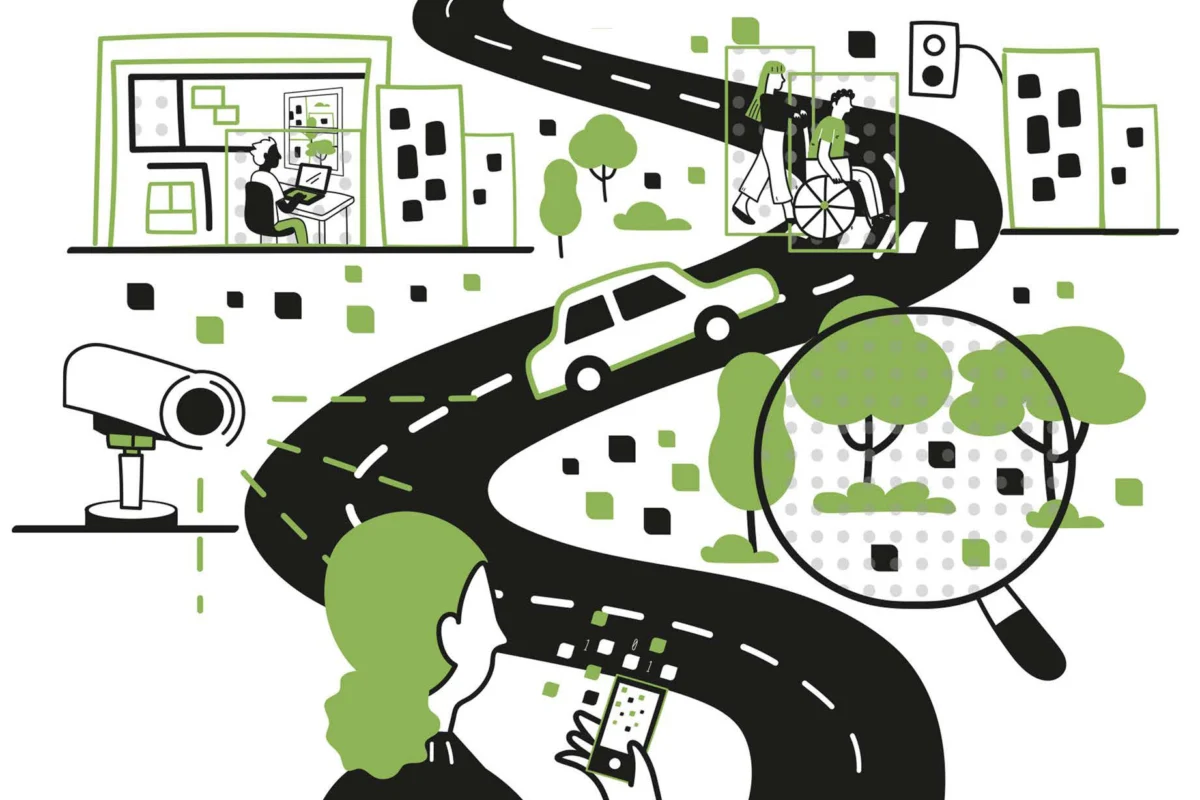
For centuries, the art of urban planning relied on the limited scope of the human eye. From the marble maps of ancient Rome to the meticulous, hand-drawn sketches of 20th-century luminaries like Kevin Lynch, understanding a city meant being present within it—observing street life, documenting architectural shifts, and interpreting the flow of pedestrians through the lens of individual experience.
Today, that tradition is undergoing a radical metamorphosis. Researchers at the MIT Senseable City Lab have ushered in a new era of "Urban Visual Intelligence," where the city is no longer just a physical space to be walked, but a massive, fluid dataset to be analyzed. Their new book, How AI Sees the City: Urban Visual Intelligence (Routledge), explores how machine learning and computer vision are allowing us to "see" the urban environment with a precision and scale that was previously the stuff of science fiction.
The New Frontier: Machine Learning in the Streets
The technological shift is exemplified by a recent breakthrough from MIT researchers: the ability to quantify urban pollution in real-time. By deploying machine learning algorithms across 331 traffic cameras in New York City, the team identified specific vehicle types and estimated the emissions generated by each. This represents a seismic shift in environmental monitoring. Rather than relying on sporadic, localized sensors, urban planners can now monitor air quality at an unprecedented level of granularity, linking specific traffic behaviors to environmental outcomes across an entire metropolis.
However, the applications extend far beyond emissions. Visual AI is currently being deployed to answer the fundamental questions that have plagued urbanists for decades: Why does traffic coagulate at specific intersections? Which design elements make a public plaza feel "safe" or "inviting"? How does the presence of greenery in a commuter’s peripheral vision influence their reported psychological well-being? By treating every digital image as a structured dataset, researchers are transforming the chaotic visual input of a city into actionable, quantitative insights.
A Chronology of Urban Observation: From Pen to Pixel
To understand the current revolution, one must place it in the context of urban history. The authors of How AI Sees the City—Fábio Duarte, Martina Mazzarello, Carlo Ratti, and Fan Zhang—frame AI not as an alien replacement for human planning, but as a technological evolution of a long-standing practice.
The Age of Physical Documentation (Pre-20th Century)
Historically, visual representation was static. Whether it was the mapping of Paris during the Haussmann renovations or 19th-century photography capturing the dense, grim reality of New York’s Lower East Side tenements, these images served as the primary tools for reformers and planners. They were snapshots that forced society to confront the physical state of their cities.
The Human-Centric Era (1960s–1990s)
In the mid-20th century, giants of urban studies shifted the focus toward human perception. Kevin Lynch’s seminal 1960 work, The Image of the City, argued that the way people "read" their environment determines the success of urban design. Simultaneously, sociologist William H. Whyte began using time-lapse photography to study how people actually used public plazas. These thinkers established the methodology: observation leads to insight, which informs policy.
The Computational Turn (2004–Present)
The founding of the MIT Senseable City Lab in 2004 marked the beginning of the data-driven era. Initially focused on mobile phone data and sensor networks, the lab’s work has now converged with the explosion of computer vision. Today, the "pen and paper" of Kevin Lynch have been replaced by neural networks capable of processing millions of frames of video, identifying patterns in human behavior that are invisible to the naked eye.
Supporting Data: Scaling the Invisible
The power of this new methodology lies in its ability to synthesize disparate data points. As Fan Zhang, an assistant professor at Peking University and co-author, notes, the promise of visual AI is the ability to connect the "visible" (streets, trees, buildings) with the "experiential" (how a city functions for its citizens).
A prime example of this is the lab’s global analysis of Airbnb interior listings. By scanning 400,000 images, researchers found that the "globalization" of design is not as monolithic as critics suggest. Instead, the AI revealed distinct, persistent geographic signatures in interior design, suggesting that local culture remains a powerful, visible force in an increasingly digital world.
Furthermore, the scale of current visual AI is staggering. While human researchers might observe a handful of public spaces over the course of a year, an AI system can analyze thousands of hours of footage simultaneously. This allows for a "global" perspective on local issues, such as the correlation between urban greenery and health outcomes, or the impact of street-level infrastructure on pedestrian safety.
Official Responses and Theoretical Frameworks
The contributors to How AI Sees the City emphasize that these tools are fundamentally an extension of human intention. "Great urbanists… showed us the extraordinary value of ‘looking’ at the city," says Carlo Ratti, director of the MIT Senseable City Lab. "Today, visual AI gives us new ways to build on that tradition."
However, this enthusiasm is tempered by a clear-eyed assessment of the risks. The authors argue that AI is not a neutral arbiter. It is a mirror. If an AI is trained on biased data—or if it is designed to prioritize the convenience of the majority while ignoring minority experiences—it will institutionalize those biases.
"We need to teach AI to see, and depending on how you teach it, it will see what is embedded in the culture," explains Fábio Duarte. "AI is not neutral." This sentiment is echoed by Martina Mazzarello, who notes that even the human eye is subject to cultural conditioning. The objective of the new urban visual intelligence, therefore, is not to achieve an impossible "perfect" neutrality, but to build systems that are transparent, guided by ethical frameworks, and subject to constant human oversight.
The Ethical Implications: Surveillance vs. Service
The integration of ubiquitous visual sensors raises profound questions regarding privacy and civil liberties. The book highlights the stark disparity in global camera density. London, once the poster child for CCTV, pales in comparison to cities like Shanghai, which boasts over 5,000 cameras per square mile.
The authors issue a sobering warning: the benefits of traffic optimization and safety monitoring must be weighed against the potential for an "erosion of personal freedom." As visual AI becomes more capable—moving from identifying vehicles to recognizing human activities and emotions—the potential for government or corporate abuse increases exponentially.
The challenge, according to the authors, is one of governance. Can we harness the power of visual AI to create more breathable, walkable, and efficient cities without creating a panopticon? The authors suggest that the answer lies in "independent thinking" and "critical design." We must treat AI as a tool that serves the public good rather than a technology that dictates it.
Conclusion: A Wise and Creative Path Forward
The future of the city is undoubtedly visual. As we continue to equip our urban environments with sensors and cameras, we are essentially giving our cities a nervous system that can "see" and "react." The work of the MIT Senseable City Lab serves as a foundational text for this transition, arguing that we are entering a phase where the digital and physical realms are indistinguishable.
The path forward, as the authors conclude, requires a delicate balance. We must be "wise, critical, and creative." We must leverage the ability of AI to analyze the urban form at a scale previously unimaginable, while simultaneously guarding against the dehumanizing effects of constant, automated surveillance.
The city of the future will be defined by how we choose to use these eyes. If we succeed, we may finally be able to build cities that are as responsive to their citizens as they are to the data that flows through their streets. If we fail, we risk building a future that is efficient, yet fundamentally unfree. The choice, the authors remind us, remains human.