








WASHINGTON — In a milestone that could fundamentally reshape how humanity navigates the cosmos, NASA’s Starling mission has successfully demonstrated a revolutionary autonomous navigation system. The technology allows spacecraft to determine their precise orbital positions using celestial neighbors and orbital debris as reference points, entirely bypassing the need for terrestrial networks like GPS.
The successful trial marks a monumental leap forward for deep-space exploration, autonomous satellite swarms, and space traffic management. As humanity looks toward prolonged habitation on the Moon and crewed missions to Mars, the dependence on Earth-based tracking and Global Positioning Systems is becoming an unsustainable bottleneck. The new system, known as FALCON—short for Fast Autonomous Lost-in-space Catalog-based Optical Navigation—offers a promising, self-reliant alternative.
Main Facts: The Anatomy of FALCON
At its core, FALCON is designed to grant spacecraft unprecedented operational independence. While near-Earth satellites rely heavily on GPS signals for positioning, navigation, and timing (PNT), these signals degrade rapidly, become entirely unreliable, or vanish altogether as missions venture into cislunar space and deep cosmos.
FALCON bridges this technological gap by turning a spacecraft’s optical instruments into navigation tools. Developed as a joint flight experiment between NASA and EraDrive—a commercial startup born out of Stanford University research—the payload fuses EraDrive’s proprietary Era-Core flight software and embedded algorithms with Starling’s onboard star tracker cameras and a comprehensive catalog of known space objects.
Instead of looking outward at distant stars for basic orientation, or relying on telemetry uplinks from ground stations, Starling used its cameras to actively observe nearby satellites and pieces of space debris. By comparing these observations against a pre-loaded catalog of approximately 20,000 space objects, the spacecraft calculated its own orbital coordinates with remarkable accuracy.
Furthermore, FALCON did not just passively read the catalog; it actively updated and refined it. Over a rigorous three-day testing period, the autonomous system improved the known orbital trajectories of more than 200 space objects completely unassisted by human operators on Earth. The resulting positional estimates were demonstrably more precise than the legacy catalog data supplied by ground stations.
Chronology: From University Concept to Orbit
The path to FALCON’s historic orbital triumph spans years of collaborative research, commercial incubation, and rigorous in-space validation.
- Phase I: Academic Roots (The Genesis): The technology originated as a University SmallSat Technology Partnerships project, a NASA initiative designed to foster high-risk, high-reward concepts within academic institutions. Researchers at Stanford University laid the mathematical and algorithmic groundwork for catalog-based optical navigation.
- Phase II: Commercial Incubation: Recognizing the commercial viability and deep-space utility of the research, the academic team launched EraDrive to commercialize the underlying Era-Core software and associated embedded hardware architectures.
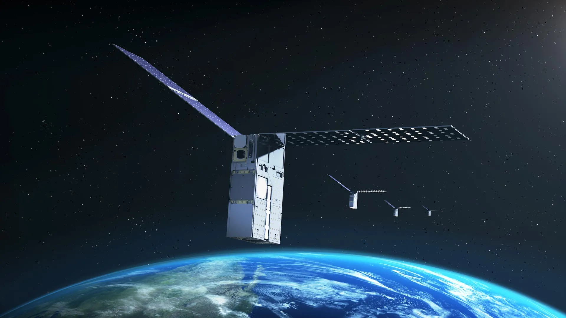
- Phase III: Launch of Starling (2023): NASA launched the Starling mission in 2023, overseen by NASA’s Ames Research Center in California’s Silicon Valley. Designed as a testbed for distributed spacecraft operations, Starling provided the ideal orbital laboratory to push experimental software to its limits.
- Phase IV: The FALCON Demonstration (Present Day): Integrated into Starling’s suite of instruments, the FALCON payload underwent active testing. During this phase, the spacecraft successfully executed autonomous PNT experiments, utilized star tracker cameras to identify orbiting debris and active satellites, and autonomously scrubbed and updated orbital catalogs without ground intervention.
- Phase V: Upcoming Multi-Spacecraft Trials (Later This Year): In the next phase of the 2023-launched mission, Starling’s four individual spacecraft will scale up the experiment. They will begin sharing tracking data amongst themselves, leveraging collective observations to cooperatively refine their orbital positions in real-time.
Supporting Data: Numbers Behind the Mission
The technical metrics achieved during the FALCON trials underscore the viability of optical, catalog-based navigation for future space architectures:
- 20,000: The approximate number of space objects and predicted orbits loaded into Starling’s onboard catalog prior to the test.
- 200+: The total number of space objects whose orbital trajectories were successfully refined and improved by FALCON over a tight, three-day testing window.
- 0: The amount of ground-based operator intervention required while FALCON recalculated orbits and determined the Starling spacecraft’s position.
- 4: The number of coordinated spacecraft comprising the Starling mission constellation, which will soon pool their optical data for collaborative swarm navigation.
- 1st: In the history of spaceflight, this marks the first time a spacecraft has successfully used optical cameras to navigate its own orbit relative to other dynamic space objects and subsequently upgraded an onboard catalog of orbital debris autonomously.
Official Responses: What Leadership is Saying
The success of the Starling mission and the FALCON payload has drawn high praise from NASA leadership, who view the technology as a watershed moment for the small spacecraft community.
"FALCON is yet another success for the Starling demonstration mission," said Roger Hunter, program manager for NASA’s Small Spacecraft and Distributed Systems program at NASA’s Ames Research Center in California’s Silicon Valley. "The results from FALCON can have far-reaching implications for on-orbit space-traffic monitoring, collision avoidance, and alternative navigation."
Hunter highlighted the relentless pace of innovation coming out of the small satellite sector, adding, "The number of ‘firsts’ from Starling just keeps growing."
Engineers and mission architects at EraDrive have similarly celebrated the flight results, noting that the validation of Era-Core software in the harsh, high-radiation environment of low Earth orbit de-risks the technology for broader commercial and civil applications. By proving that advanced flight software can turn standard star trackers into sophisticated navigation and tracking sensors, the collaboration has paved the way for widespread industry adoption.
Implications: A New Era for Deep Space and Traffic Management
The implications of FALCON’s success extend far beyond a single technology demonstration. As the orbital environment becomes increasingly congested and humanity looks outward toward the Moon and Mars, traditional reliance on ground-based tracking networks and GPS is rapidly approaching its limits.
1. Enabling Cislunar and Deep-Space Exploration
Missions to the lunar surface, Gateway space station, or Martian habitats cannot rely on Earth-centric positioning networks. Spacecraft operating in deep space require autonomous systems that can calculate trajectories locally. FALCON proves that a spacecraft can navigate using its immediate environment, reading the celestial landscape of active satellites and defunct debris much like ancient mariners used constellations to cross Earth’s oceans.
2. Revolutionizing Distributed Science
Future space exploration will heavily feature "distributed science missions"—formations of multiple satellites working in unison to collect simultaneous measurements of space weather, planetary magnetic fields, or cosmic phenomena. For these formations to produce valid scientific data, the relative positioning of each spacecraft must be known down to fractions of a meter. FALCON’s multi-agent navigation capabilities ensure tight synchronization without placing heavy administrative burdens on ground control teams.
3. Enhancing Space Traffic Management and Collision Avoidance
With tens of thousands of active satellites and pieces of orbital debris circling Earth, space traffic management is an escalating crisis. Ground-based radar networks can lose track of objects, and updating catalog positions manually is slow and resource-intensive.
By empowering satellites to update orbital catalogs onboard and in real-time, systems like FALCON can transform every spacecraft into an active space-surveillance asset. Satellites equipped with this technology can autonomously detect positional anomalies in neighboring objects, calculate collision risks, and execute avoidance maneuvers independently, safeguarding multi-billion-dollar assets against catastrophic impacts.
4. Spurring Commercialization and Public-Private Partnerships
The journey of FALCON—from a university research initiative under NASA’s SmallSat Technology Partnerships to a commercialized product via EraDrive—highlights the success of NASA’s model for technology transfer. By providing flight-testing opportunities like the Starling mission, NASA bridges the "valley of death" that often traps academic innovations, helping startups mature vital infrastructure for the burgeoning New Space economy.
As the Starling mission prepares for its upcoming multi-spacecraft collaborative trials later this year, the aerospace industry watches closely. The era of the self-navigating, autonomous satellite is no longer a science-fiction concept; thanks to Starling and FALCON, it is an operational reality.